This hidden and remote journey begins from Drukgyel Dzong in the northern end of Paro Valley and it is rated with medium-hard one taking trekkers through diverse terrain and sacred mountains, offering amazing views of some of the most pristine and unspoiled landscapes of Bhutan. With its diverse flora and fauna, as you ascents and descent, you will travel through the meadow laden with flowers, junipers and medicinal plants, through birch and fir forest, yak herders in high altitude pastures, with view of some of the sacred mountains, isolated villages, mountain passes adorned with prayer flags. Along the trail, you will also be able to spot some of the wild indigenous animals of Bhutan like – Blue Sheep and Takin.
The trek is best undertaken in the months of April – June and September – November.
Duration: 19 Days | 18 Nights
Detailed Itinerary
Day 01: Arrival at Paro
Your in-flight to Bhutan offers breathtaking scenery of Himalayan mountain ranges including the world highest peak Mt. Everest and Kanchengunga. As your in-flight lands to the enchanting Paro airport, our local tour executive will give a traditional reception and following your pick up, you will be transferred to your hotel for leisure. If time permits you will be taken for sightseeing and leisurely walk through Paro valley – including a visit to 17th century Paro Dzong (fortress) locally called “fortress on the heap of jewels” roughly lies in the centre of the valley towering a valley below. This dzong was built by Zhabdrung Ngawang Namgyel in 1646. This dzong (fortress) is one of the Bhutan’s strongest and important fortresses. The dzong can be approached by crossing a cantilever bridge with a shingle roof. Driving further up from the dzong, your next stop is the National Museum or Ta Dzong ( Watch Tower), built in 1649 by La-Ngonpa Tenzin Drukdra and later in 1968 the “Ta Dzong” was established as the National Museum of Bhutan and re-named as “Namse Bangdze”. Returning from the National Museum, make a short stop at Jangsa Dumtse Lhakhang en-route to the town.
In the evening make a leisurely walk through Paro Town, which is a small village now transformed into a small town consisting nearly fewer than 3000 souls.
Day 02: Hike to the Famous Tiger’s Nest
Today after your early breakfast in the hotel (6:00 – 700 am), it’s now time to embark on your somewhat arduous adventure of the day. The highlight of your day excursion will be graded as unforgettable memories as the incredible Tiger’s Nest is adventurously perched on 915 meters from the basement. This 4-5 hours hike depends upon the physique of an individual. However, it is done to accustom trekkers to the mountain altitude. Tiger’s Nest or Tiger’s Layer is one of the most religious site in the country with its history dated back to eight century. Legend says, when Guru Rinpoche flew on the back of his consort, pregnant tigress (Khandro Yeshay Tshogyel) from Tibet en-route Singye Dzong with a mission to subdue evil spirit dwelling in the Himalaya region of Bhutan brought to fruitions after a long three month meditation in the existing cave. Upon his blessing and prophecy, the temple was built like the structure that you see today in 1694 and unfortunately the old structure was completely burned down by fire in 1998 and in the same year it was rebuild and revamped in 2005. After the Tiger’s Nest, you will descent down the same route and drive back to visit Kyechu Lhakhang, Legend says this temple is one of the 108 temple built by dharma king Songtsen Gampo within a single day in the year 643 to pin down the giant ogress. It is also one of the oldest temples in Bhutan along with Jambay Lhakhang in Bumthang. After the temple, you will be transferred to your hotel for leisure.
Day 03: Guinitsawa Village – SharnaZampa
After your breakfast in the hotel, you will be driving further 16 Km away from the town to Drukgyel Dzong, make a short visit to the ruined Drukgyel Dzong, though the dzong lies in ruin it has a great historical significant that goes back to 17th century. In this dzong the Bhutanese repelled many Tibetain. The name means the victorious fort. From here the majestic view of Mt. Jomolhari can be visible; towering at 24,00ft/7314m pyramid shape, snow-clad that lies far end of the border of Tibet and it is revered as the abode of goddess Jomo. Drive further north of Drukgyel Dzong to Guinitsawa village where your trekking expedition begins. Your campsite will be somewhere close to Guinitsawa, which is on the other side of the river (Paa Chhu).
Day 04: SharnaZampa – Thangthanka
Today your trek journey will lead you to Soi Thangthanka. As the trail continues you will be making numerous ascend and descent as you traverse through meadow laden flowers, juniper and some medicinal plants. The journey takes you through deep forest filled with oak, rhododendron, fir and birch. Heading further, you will gradually descend to a meadow where a camp will be set up. If the weather is appealing this campsite provides you with another best spot for the great view of Mt. Jomolhari.
Day 05: Thangthanka – Jangothang
Today after your breakfast you will be heading to one of the finest and beautiful campsite in the Himalaya the “ Jomolhari Base Camp”. Your journey brings you up the Paa Chu valley leading you through alpine meadow with scanty growth of forest, yak pastures with nomadic herders and their stone houses scattered throughout, Buddhist prayer flags held high in its glory and a remnant of a fortress which lies in ruin was used to fend the valley from Tibetan invasion and a spectacular backdrop of Mt. Jomolhari looming at the valley head.
Day 06: Jangothang Halt
After a long continuous 03 days walk, the rest day in Jangothang usually spent time in camp, acclimatizing and drinking in the magnificent view of Mt. Jomolhari. This rest day provides several possibility of half-day walk with breathtaking views of snowcapped mountains like – Mt. Jomolhari (7326m) along with Mt. Jichu Drakey (6794m), and the high altitude lakes. The region here also provides a great chance to spot some of the blue sheep. If you have a fishing license, you can even choose to go for fishing in the high altitude lakes, Tshophu.
Day 07: Jangothang – Lingshi
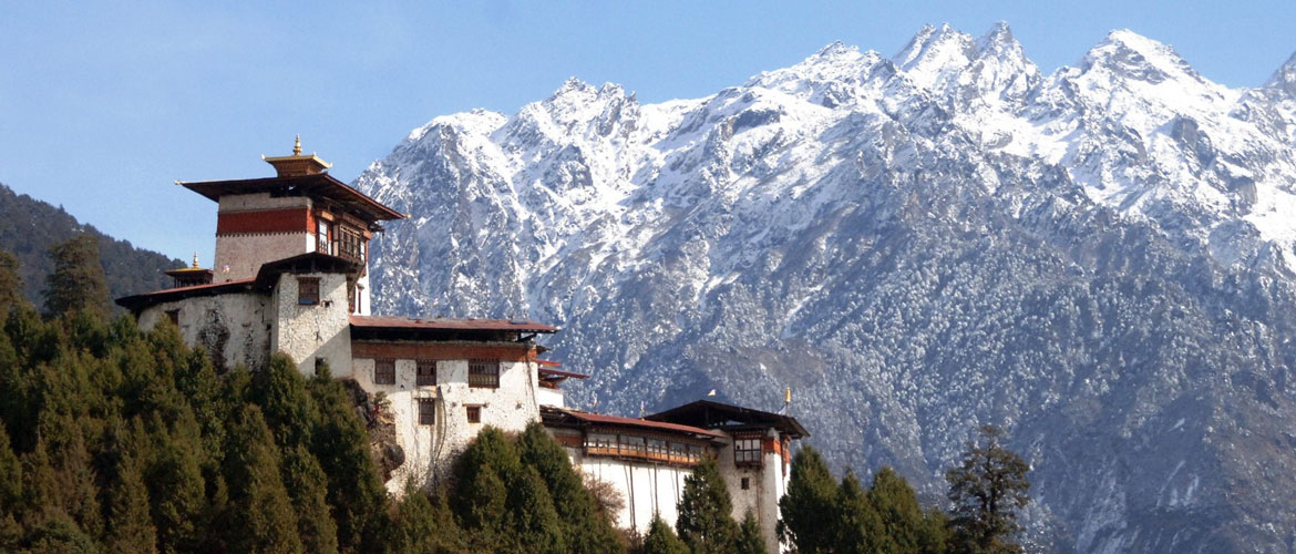
Jangothang to Lingshi is considered as the longest journey of this trek. So we recommend you to make an early start. As you head further, just after ten minutes from the campsite the magnificent Mt. Jichu Drakey (6989m) and Mt. Tserim Gang (6789m), appears their presence. As the trail begins rapidly, the final pull begins a gradual ascent to Nyilila Pass (4870m) which usually takes four hours from the base camp till the top of the pass. Enjoy the surrounding while climbing the pass and en-route you might encounter a herds of Blue Sheep grazing around the mountain slope. Once you reached the top of the pass, there you will have a spectacular view of Mt.Jomolhari (7326m), Mt. Jichu Drakey (6989m), Mt. Therim Gang (6789m). From here, your journey descent downhill till you reached your campsite opposite of Lingshi Village. As you continue, you will pass by some yak herder’stent, which is made from yak hair. These unique tents were usually pitched along the region by yak herders while traveling towards their pastures along with their herds of yaks for grazing. Reaching the campsite, you will have a wonderful view of Lingshi Dzong on a clear weather along with Mt. Tserim Gang raising its presence at the north end of the valley.
Day 08: Lingshi – Chebisa
As you begins your journey just after few minutes, you will reach a chorten (stupa) and then the Lingshi Dzong, kindly make a short visit to the dzong. This magnificent dzong perched on the top of the hill provides a commanding view of the surrounding green hills with winding river that flows through the valley and magnificent peaks surrounds. The dzong was built in 17th century. After your visit of Lingshi Dzong the trail pass through a small compact village of Lingshi and then reaching a ridge at 4140m, the trail gradually descent downhill to a pleasant settlement of Goyul village at an altitude of 3870m. Crossing the village of Goyul, your trail leads you through small ascent and descent and the route finally reaches to a Chebesa where you will be holding your night camp. Depending upon your interest once reaching the campsite, you have plenty of time to explore the village house of Chebesa and also there is a waterfall behind the village which will give you a new look and worth your visit.
Day 09: Chebesa – Shomuthang
We recommend you to make an early start because from the village of Chebesa through a wide pastureland towards the Gobu-La Pass (4510m) will take you uphill around 3 hours. On this day you will also have an opportunity to spot the Blue Sheep above the trail, Branded Vultures, Himalayan Griffons and also chances of encountering with nomadic people raising their yaks and several yak herders hut en-route. After crossing the pass, you will descent down to the valley through rhododendron bushes and a stream at about 4170m. The trail from here again ascent a short uphill through a cedar forest and then descent downhill through deep forest of fir and birch and then finally reaches to the village of Shakshepase (3980m), a large U-shape valley. There are several yak herders camps en-route and climbing from here you will finally reach the campsite at Shomuthang (4200m), in a cluster of brush beside the river. The river below your camp is a tributary of Nochu River.
Day 10: Shomuthang – Robluthang
Today your journey begins by ascending up the valley to Jhari-La Pass (4750m) with a view of Mt. Khang Bum(6539m) and also un-route you will encounter Edelweiss (the national flower of Austria). As your journey further continues, you can catch the first glimpse of Sinche La Pass and on the northern side the view of the giant Mt. Gangchen Ta (6840m). Depending upon the clarity of the weather, you will also have the opportunity to view Mt. Tserim Gang and the tip of Mt. Jomolhari. From here, you will descent downhill to Tseri Jathang valley, a campsite by the river. This place is known for the summer residence of the rare Himalayan Takin which is the national animal of Bhutan “Takin”, the animal migrate here in the summer and remain for nearly 4 months. This valley has also been declared as the “Takin Sanctuary”. From here you will climb up a bit through rocky meadows and finally reaches to the campsite at Robluthang.
Day 11: Robluthang – Limithang
Today you will have to climb one of the highest pass on this trek, the Sinche La Pass (5005m). This pass is one of the final and high pass and takes around five hours. Crossing the pass you will gradually descent downhill and as to the far side of the pass you will have a glimpse of impressive terminal moraine and glacier lakes at the foot of the valley. Below this moraine you will pass through rough, rocky trail into a glacial valley, you will reach eventually to Kongo Chhu (stream) and from here a short climb takes you through rhododendron trail and cedar forest interspersed small meadow and soon reach to Limithang campsite with a towering peak Mt. Gangchen Ta (6840m) over the campsite though it lies quite a distance away from your campsite. The campsite of Limithang is at 2140m, and is one of the lovely with wide meadow.
Day 12: Limithang – Laya
A lovely and pleasant walk, you will traverse all the way downhill through narrow and winding river valley. This extremely pleasant walk takes you through densely forested region with moss an singing birds, you will also have a spectacular view of – Mt. Gangchen Ta (6840m) and Mt. Masagang (7165m). Finally, you will reach Laya, the village of Laya is one of the second highest village / settlement in the country at an altitude of 3,800m. Your campsite is just below the school.
Day 13: Laya Halt
Today, either you will rest in the camp or you will go around visiting the village houses on short hike.
Day 14: Laya – Koina
Today the trail leads you through winds up and down along the Mo Chhu ( Female River), with lots of ups and down you will finally reached to Koina Laptsa at an altitude of 3300m. From here your trail descent downhill and drops down to Koina Chhu (stream), and finally reach the camp site at Koina at an altitude of 3050m.
Day 15: Koina – Gasa – Gasa Hot Spring
Today your trail begins with an ascent to Bari La Pass (3900m), which is the last and final climb of your trek traversing through deep forest of fir. After reaching the pass,the trail leads downhill sometimes through steep and a bamboo forest till you reached at Gasa which lies at an altitude of 2,770m. Reaching Gasa village, further descent down for an hour until Gasa Hot Spring. This hot spring is one of the most visited tshachu in Bhutan.
Day 16: Gasa Hot Spring – Punakha
Today in the morning hour, you can revisit the hot spring and yourself in the medicinal water for an hour or two. After lunch walk down for 20 minutes and drive to Punakha, which takes around 4 hours.
Day 17: Puakha – Thimphu
Today in the morning hour before departing to Thimphu travel to explore some of the fascinating places in Punakha like Punakha Dzong and a short hike to Chemi Lhakhang. Lunch will be served in Khuruthang town and after good lunch proceed to Thimphu. En-route there will be a stopover at Dochu La Pass where on a clear day you will get a bird eye view of the great Himalayan peak. Beside this magnificent view of the Himalayan peak the spot offers 108 memorial chortens. From the top, it is all the way downhill until you reached the bustling and colorful capital city. Check in to your hotel.
Day 18: Thimphu Sightseeing – Paro
After your morning breakfast, you will be led to explore some of the important monuments in Thimphu including National Memorial Chorten, National Painting School, National Library, National Textile Museum and finally the giant golden Buddha statue. Lunch in Thimphu and after a quick lunch drive to Paro which takes around 1 hour.
Day 19: Board your flight back home
After your morning breakfast, you will be transferred to the airport for your onward destination. Your tour guide and driver will see you off at the airport.